Recent searches
Search options

Administered by:


#grassgis


I just stumbled across the site 'Interoperable Europe.' It seems worth looking into (https://interoperable-europe.ec.europa.eu/). It is an initiative of the European Commission to stimulate public sector interoperability.
There isn't much (yet) on Geo-spatial tools, but at least #grassgis is there :-). Time for #osgeo / #foss apps to be added?

Renamed a mapset in my GRASS database, and all space-time datasets in that mapset became inaccessible. Something to do with how the temporal database stores references to these space-time datasets.
Mildly annoyed at my past self for not planning mapset names better, but mostly curious now.
Time to explore how GRASS handles temporal metadata under the hood  . A bit nerdy perhaps, but I did find an admittedly hacky solution. https://ecodiv.earth/post/Fix_STRDS_references/ #grassgis #foss #LearnByDoing

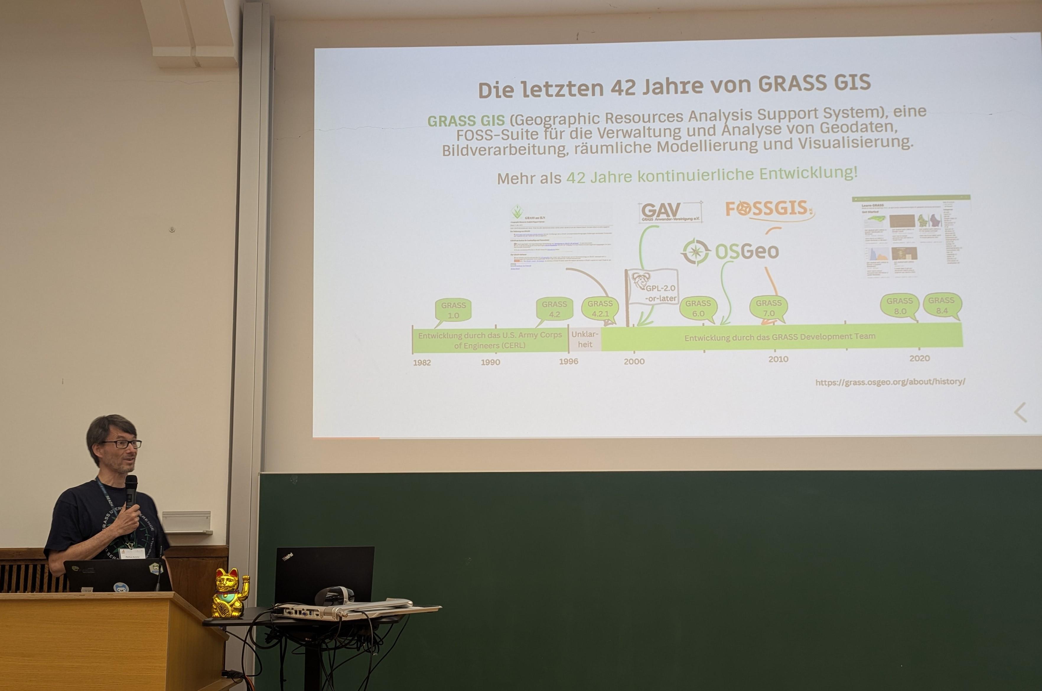
42 Jahre Timeline des #GRASSGIS Projekts. Vorgestellt von Markus @neteler auf der #fossgis #fossgis2025 @grassgis

Let us know what topics you'd like to see covered as a GRASS tutorial!
Comment your suggestions below
https://grass-tutorial.osgeo.org
#foss #osgeo #geospatial #grassgis #datascience #python #r #remotesensing #hydrology #dataengineering
https://github.com/OSGeo/grass-tutorials

It's a bit dumbfounding when you realize GRASS started around 1982 and it's still developing. #grassgis
Kick off your #GRASS journey with our brand-new tutorial site! 

https://grass-tutorials.osgeo.org
#foss4g #osgeo #openscience #geospatial #jupyter #tutorial #grassgis
https://grass-tutorials.osgeo.org
Explore species distribution modeling with Maxent in GRASS GIS? Check out my new post for a step-by-step guide!
Read more: https://ecodiv.earth/post/sdm_using_maxent_in_grassgis/
#OpenSource #grassgis @grassgis #GeoSpatial #osgeo #foss #HASgreenacademy

The first release candidate of #GRASSGIS 8.4.1 is out! Please help us test all is working as expected 

- Windows: https://grass.osgeo.org/grass84/binary/mswindows/native/WinGRASS-8.4.1RC1-1-Setup.exe
- Mac: https://cmbarton.github.io/grass-mac/download/
- Source: https://github.com/OSGeo/grass/releases/download/8.4.1RC1/grass-8.4.1RC1.tar.gz


A great thanks to #grassgis folks and hackers.
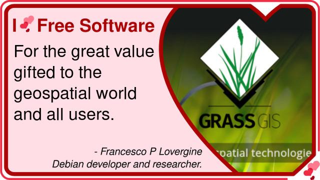
#iLoveFS #iLoveFreeSoftwareDay

Po delší pauze máme s #gismentors nový termín kurzu  @grassgis - GRASS GIS pro začátečníky, který se uskuteční v pátek 28. 2. 2025 v Praze.
 Přihlášky a podrobnosti: https://kurzy.gismentors.cz/
 materiály jsou volně k dispozici: https://gismentors.github.io/grass-gis-zacatecnik/


Need fast raster processing in R?
Check out {fasterRaster} by Adam B. Smith, an R package designed for large spatial rasters and vectors through GRASS GIS, built to complement {terra} & {sf} 
Learn more: https://buff.ly/4htiGTR


A big THANK YOU to @rsbivand for his incredible contributions to the R community, especially with #rgrass and bridging R with @grassgis. Your work has helped so many geospatial analysts.
And thanks to @scoobastep for taking over the maintenance of the rgrass package!
#GRASSGIS will also be present at #FOSS4G Asia!  Don't miss one of the keynotes by @neteler tomorrow!
𝗖𝗲𝗹𝗲𝗯𝗿𝗮𝘁𝗶𝗻𝗴 𝗳𝗼𝘂𝗿 𝗱𝗲𝗰𝗮𝗱𝗲𝘀 𝗼𝗳 𝗶𝗻𝗻𝗼𝘃𝗮𝘁𝗶𝗼𝗻: 𝗧𝗵𝗲 𝗚𝗥𝗔𝗦𝗦 𝗚𝗜𝗦 𝗣𝗿𝗼𝗷𝗲𝗰𝘁 
https://talks.geoinfo-lab.org/foss4g-asia-2024/talk/KYNT8Z/
Join us to celebrate the remarkable journey of GRASS GIS and explore its exciting future!
 More info: https://foss4g.asia/2024/


Physically-Based Hydrologic Modeling Using GRASS GIS - r.topmodel [tutorial]
--
https://workshop.isnew.info/omu-2024-r.topmodel/ <-- link to technical resource / workshop / tutorial
--
“This workshop will introduce r.topmodel (Cho 2000), the GRASS GIS module for a physically-based hydrologic model called TOPMODEL (Beven 1984)..."
#GIS #spatial #mapping #water #hydrology #Hydrologic #model #Modeling #GRASS #GRASSGIS #topmodel #workshop #tutorial #onlinelearning #TopographyModel #catchments #R #SAGA #module #ISPSO #particleswarmoptimization #algorithm #continuingeducation


#GRASSGIS folks in full swing at the #foss4g2024 Code Sprint, cultivating open-source innovation and welcoming new users!
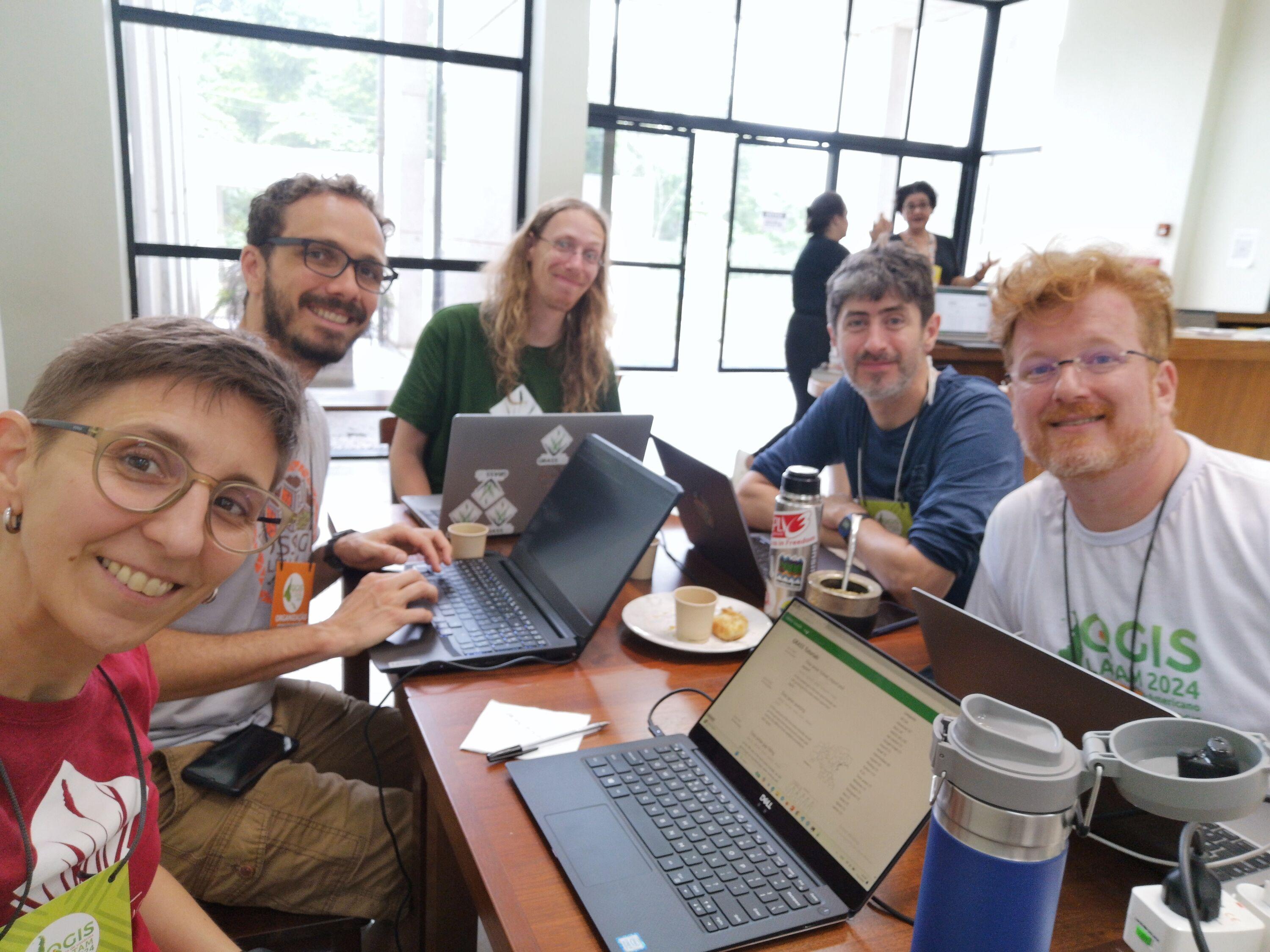
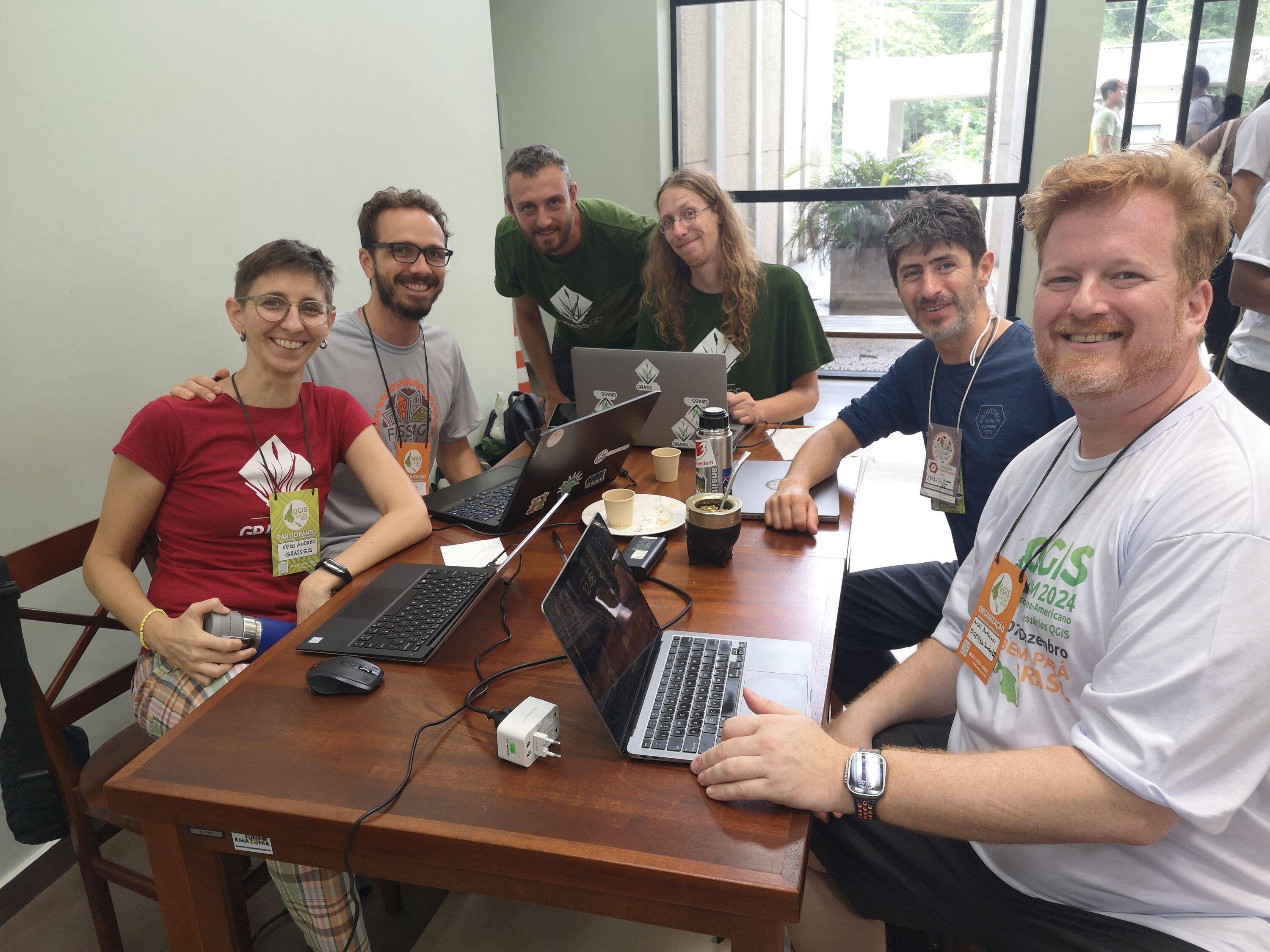
GRASS GIS at FOSS4G 2024 in Belém! 
We’re thrilled to share that the GRASS team made a strong impact at #foss4g2024 with a keynote, an engaging workshop, and an insightful talk!
But that's not all—tomorrow we'll be at the code sprint, ready to connect and collaborate. Come find us! Let's chat about all things GRASS and open-source GIS.
See you there! 


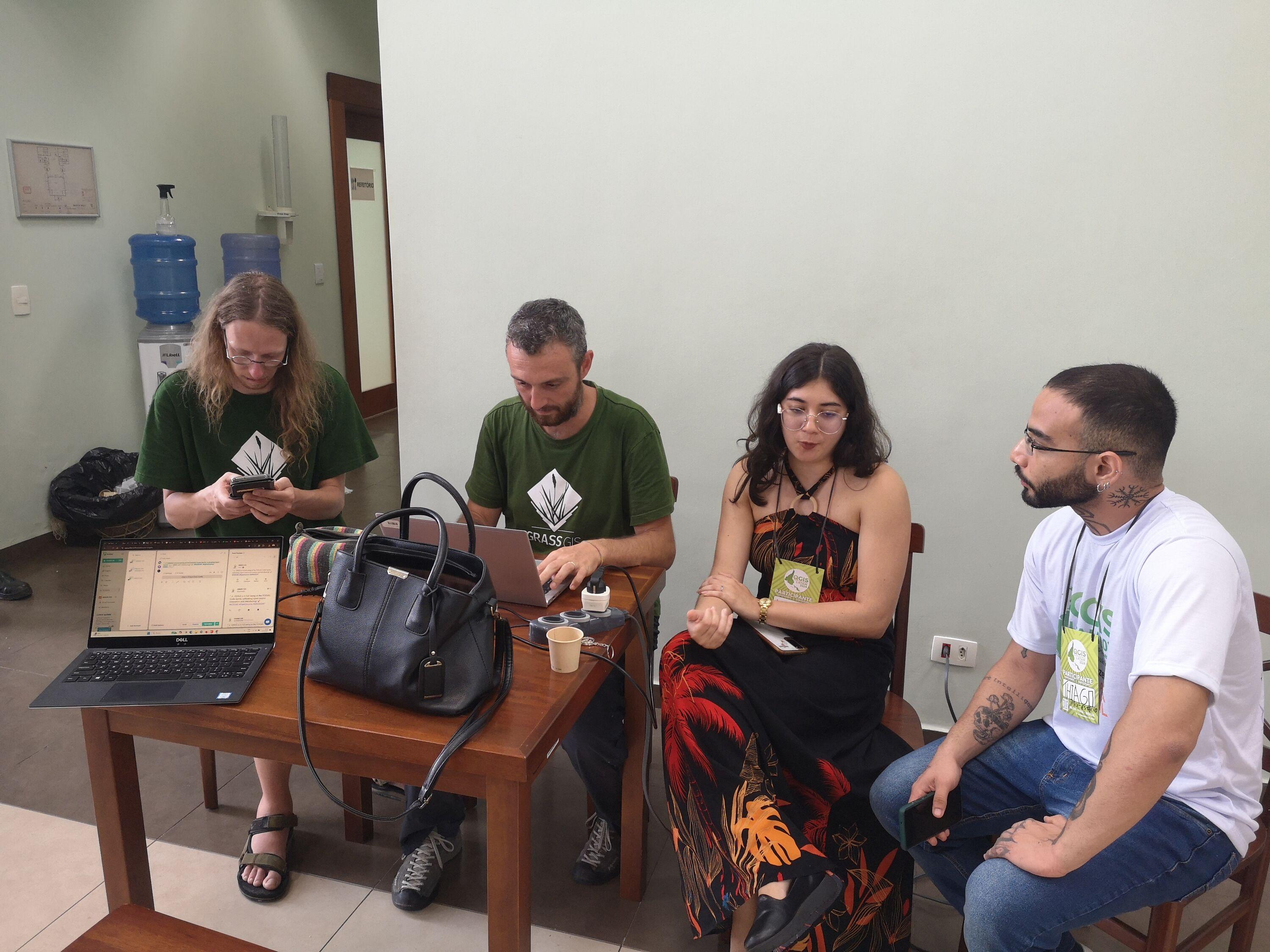
This morning I led a workshop on #GRASSGIS for #EarthObservation in Jupyter Notebooks at #FOSS4G Belem!
For those interested in diving deeper, check out the resources and materials we covered: https://github.com/veroandreo/foss4g2024_grass4rs
Just open the notebook in Google Colab and have fun!

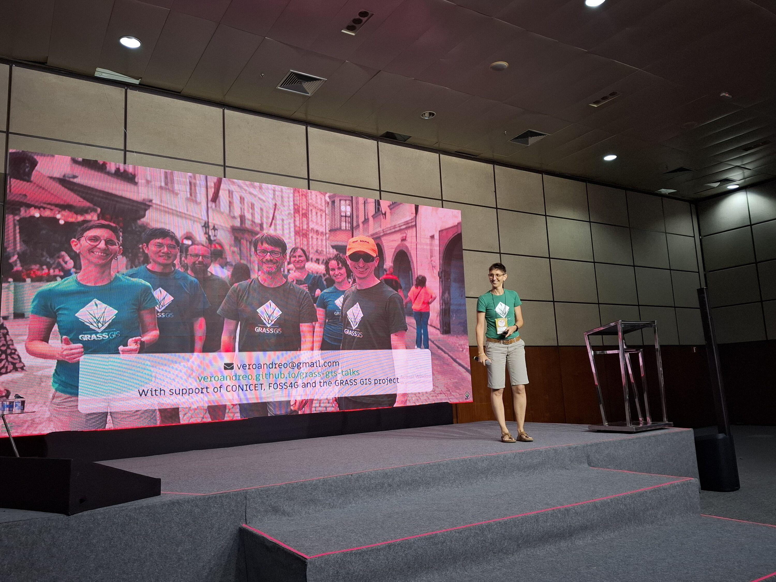
Join us at FOSS4G Belém, Brazil! 
We are thrilled to invite you to next week's GRASS GIS talks and workshop at the FOSS4G conference 
Workshop:
𝗚𝗥𝗔𝗦𝗦 𝗚𝗜𝗦 𝗳𝗼𝗿 𝗘𝗮𝗿𝘁𝗵 𝗢𝗯𝘀𝗲𝗿𝘃𝗮𝘁𝗶𝗼𝗻 𝗱𝗮𝘁𝗮 𝗽𝗿𝗼𝗰𝗲𝘀𝘀𝗶𝗻𝗴 𝘄𝗶𝘁𝗵 𝗝𝘂𝗽𝘆𝘁𝗲𝗿 𝗻𝗼𝘁𝗲𝗯𝗼𝗼𝗸𝘀 

Talks:
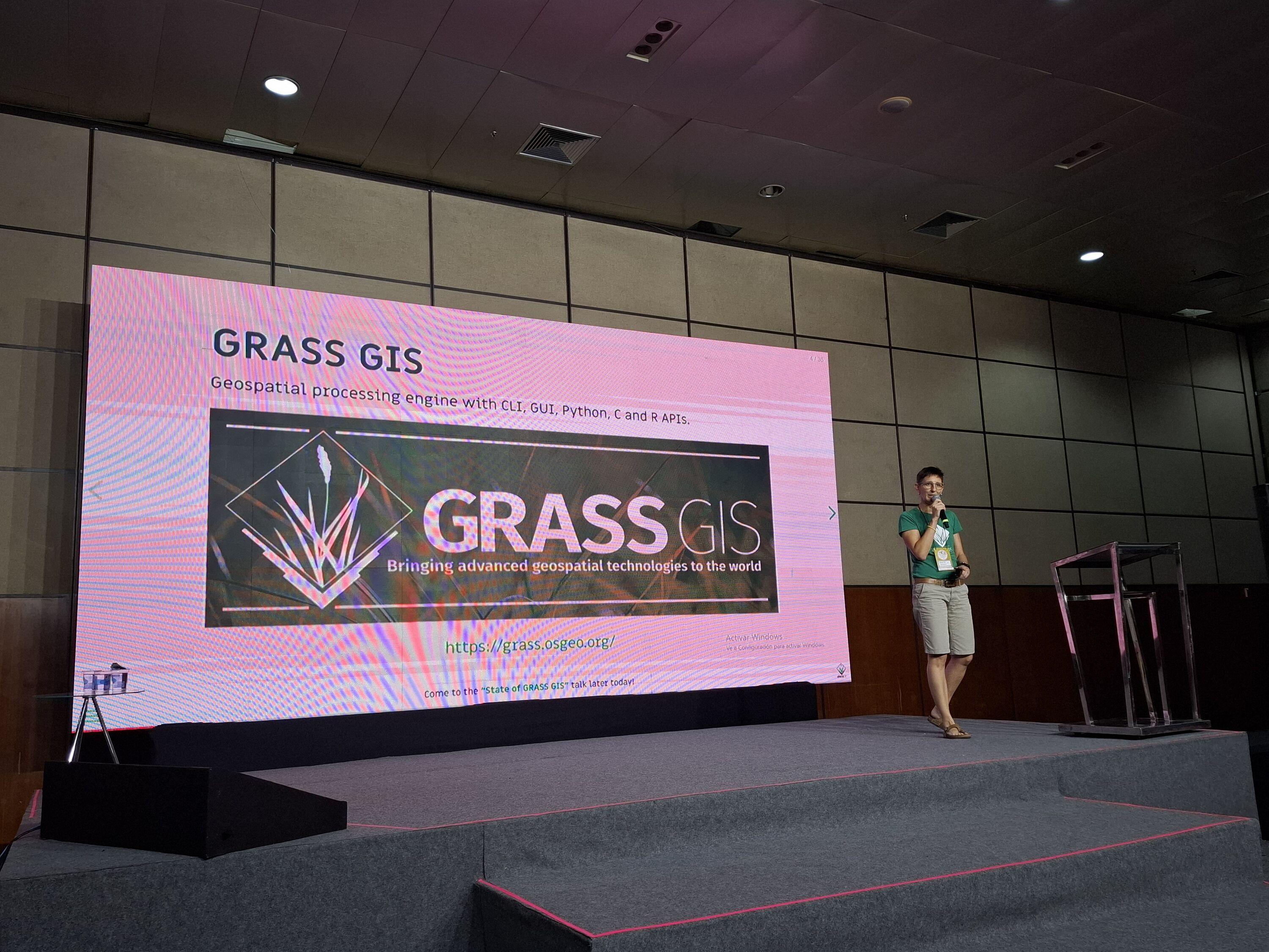
- 𝗦𝘁𝗮𝘁𝗲 𝗼𝗳 𝗚𝗥𝗔𝗦𝗦 𝗚𝗜𝗦
- 𝗙𝗿𝗼𝗺 𝗳𝗶𝗲𝗹𝗱 𝗯𝗶𝗼𝗹𝗼𝗴𝘆 𝘁𝗼 𝘁𝗵𝗲 𝗚𝗥𝗔𝗦𝗦 𝗚𝗜𝗦 𝗯𝗼𝗮𝗿𝗱: 𝗔 𝗝𝗼𝘂𝗿𝗻𝗲𝘆 𝗼𝗳 𝗢𝗽𝗲𝗻 𝗦𝗼𝘂𝗿𝗰𝗲 𝗗𝗶𝘀𝗰𝗼𝘃𝗲𝗿𝘆 𝗮𝗻𝗱 𝗡𝘂𝗿𝘁𝘂𝗿𝗶𝗻𝗴 𝗮 𝗡𝗲𝘄 𝗚𝗲𝗻𝗲𝗿𝗮𝘁𝗶𝗼𝗻 𝗼𝗳 𝗖𝗼𝗻𝘁𝗿𝗶𝗯𝘂𝘁𝗼𝗿𝘀

#OSGeo #FOSS4G #GRASSGIS #OpenSource #Geospatial #EO #GIS
https://2024.foss4g.org/en/
