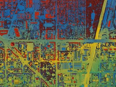
Nigeria Advances with Visionary Smart Cities and Geospatial Tech #WestAfrica #advances #Cities #Geospatial #Nigeria #Smart #Tech #Visionary
https://tinyurl.com/2b4zgt3e
Recent searches
Search options
#geospatial
Near Me widget for #spatial #analysis in #ArcGIS Experience Builder https://tinyurl.com/vr6wfv5s
#location #intelligence #GIS #esri #mapping #GISchat #geospatial #ArcGISApps #mapstodon @esri @esrifederalgovt @esrislgov @arcgisapps @esritraining @urisa
If you create, or are curious about, #VectorTiles, you may have come across the command line utility #Tippecanoe (TIP-ə-kə-NOO). It’s probably no secret that its usage is not entirely trivial, but there is a helpful tool for this now. https://spatialists.ch/posts/2025/04-04-tool-tip-tippecanoe-command-generator/ #GIS #GISchat #geospatial #SwissGIS

If you are looking for fresh reads on GIS, geospatial technologies and research, cartography, maps, and more, this list of the 𝟭𝟬𝟬 𝗯𝗲𝘀𝘁 𝗚𝗜𝗦 𝗯𝗹𝗼𝗴𝘀 𝟮𝟬𝟮𝟱 is a great starting point: https://bloggers.feedspot.com/gis_blogs/
We are proud to see our own GIScience blog near the top of the ranking: https://giscienceblog.uni-heidelberg.de/
US-Disaster: Die Zollkarte / Tariffs Map https://geoobserver.de/2025/04/04/us-disaster-die-zollkarte/ #Tariffs #Map #gistribe #gischat #fossgis #foss4g #OSGeo #spatial #geospatial #gis #geo #geoObserver pls RT via @mapadenoticias
Join us at the #GRASSDevSummit2025 at NC State!
Connect with fellow developers, share your skills, and help shape the future of #GRASS as a top geoprocessing engine. Dive into strategic planning and discover ways to expand our community's contributions. It's your chance to learn and contribute to long-term innovation in geoprocessing!
Can't make it? You can still support us by sponsoring the event for just $20!
GIS-Wissen: Resampling / GIS knowledge: Resampling https://geoobserver.de/2025/04/03/gis-wissen-resampling/ #resampling #gistribe #gischat #fossgis #foss4g #OSGeo #spatial #geospatial #gis #geo #geoObserver pls RT
Last week, we hosted "Advances in Spatial Machine Learning 2025", a two-day workshop tackling open challenges in the field.
From validation to uncertainty analysis, we explored key topics with top researchers.
Now, we're working on synthesizing outcomes—stay tuned!
Finally a new #Shapely feature release!
Shapely 2.1.0 highlights include initial support for geometries with M or ZM values, functionality for coverage validation and simplification, and a set of other new top-level functions.
For a full overview, see https://shapely.readthedocs.io/en/latest/release/2.x.html#version-2-1-0
Faces Behind the Data, Anna He and the Harvard #Geospatial Library
https://mapping.share.library.harvard.edu/posts/faces-behind-the-data-anna-he/

#Geospatial analysis of cholera outbreak in Lusaka, Zambia, between 2023 and 2024
https://tropmedhealth.biomedcentral.com/articles/10.1186/s41182-025-00718-4

In the field of #RemoteSensing, precision and reliability are critical for capturing and analyzing data that drives decision-making across a wide range of industries. Optical filters are tailored to meet the unique requirements of many applications, such as #geospatial #mapping, #hyperspectral imaging, #environmental monitoring, #agricultural health, #weather and #cloud monitoring, #LiDAR and 3D #earth mapping. Learn more: https://ilphotonics.com/optical-filters-for-remote-sensing-applications/

First day of the #stapi sprint at #developmentseed was fueled by lots of interesting discussions on issues like intersections with #stac and #ogcapi . Looking forward to more, tomorrow! #standards #geospatial #eo
Open SAR data: Synthetic Aperture Radar (#SAR) is an interesting #remotesensing technology that captures high-resolution data of the Earth’s surface, regardless of weather or lighting conditions. This curated collection of open SAR data sources provides an...
https://spatialists.ch/posts/2025/04-01-open-sar-data/ #GIS #GISchat #geospatial #SwissGIS

In 1 week, @esri webinar: Enhance Your #Business Decisions with #ArcGIS for #Microsoft https://tinyurl.com/4ff7crha
#location #spatial #intelligence #geospatial #GIS #esri #mapping #GISchat #ArcGISApps #mapstodon @esrifederalgovt @esrislgov @esritraining @arcgisapps @urisa @msftnews
Just stumbled upon this list of awesome #geospatial companies!
A list of 700+ geospatial companies & interactive map. For finding geospatial jobs, customers and understanding the geospatial industry!
The largest competitor to proprietary #GIS is open source software and tools – #FOSSGIS infrastructure is now at a level where municipalities and companies shift away from proprietary solutions. Would anyone happen to have any material (case studies etc.) on this topic to prove this point?
#QGIS #Esri #Geospatial


