techhub.social is one of the many independent Mastodon servers you can use to participate in the fediverse.
A hub primarily for passionate technologists, but everyone is welcome

Administered by:

Server stats:

5.4K
active users

#gischat

26 posts22 participants4 posts today

If you create, or are curious about, #VectorTiles, you may have come across the command line utility #Tippecanoe (TIP-ə-kə-NOO). It’s probably no secret that its usage is not entirely trivial, but there is a helpful tool for this now. spatialists.ch/posts/2025/04-0 #GIS #GISchat #geospatial #SwissGIS

spatialists.ch – geospatial newsTool tip: Tippecanoe Command Generator – spatialists.ch – geospatial news
More from Spatialists

I think I already asked something similar a few weeks back, but isn't there a public site where I can fetch #Copernicus GLO-30 #DEM files with a simple http client anymore? I used to use `wget` for this, then it was AWS CLI, and now it seems I have to set it up with a user/pass/key/secret_key?

I remember cloning the whole mapzen repo when it was on peril of disappearing, should I have done the same with data that's supposed to be public? Has anyone done that already?

Open SAR data: Synthetic Aperture Radar (#SAR) is an interesting #remotesensing technology that captures high-resolution data of the Earth’s surface, regardless of weather or lighting conditions. This curated collection of open SAR data sources provides an...
spatialists.ch/posts/2025/04-0 #GIS #GISchat #geospatial #SwissGIS

spatialists.ch – geospatial newsOpen SAR data – spatialists.ch – geospatial news
More from Spatialists

#GISCHAT TIL github.com/locationtech/geotre

"GeoTrellis is a Scala library and framework that provides APIs for reading, writing and operating on geospatial raster and vector data. GeoTrellis also provides helpers for these same operations in Spark and for performing MapAlgebra operations on rasters. "

GeoTrellis is a geographic data processing engine for high performance applications. - locationtech/geotrellis
GitHubGitHub - locationtech/geotrellis: GeoTrellis is a geographic data processing engine for high performance applications.GeoTrellis is a geographic data processing engine for high performance applications. - locationtech/geotrellis

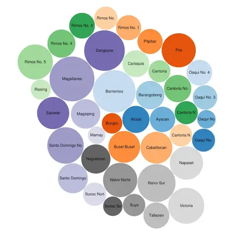
Done mapping all 40 #barangays of Luna, La Union, #Philippines 🇵🇭 in #OpenStreetMap, creating their #Wikidata items, and linking the two with each other.

A huge thanks to JR Dizon of the Luna Municipal Planning and Development Office for the boundary data. 🙏

Wanna play around? Here is the Overpass Turbo query: overpass-turbo.eu/s/21s0

And here is the Wikidata Query Service (WDQS) query: w.wiki/DfYz

Previously: en.osm.town/@seav/114092122864